What is Crosshole Seismic Survey?
Crosshole seismic surveying is a geophysical method used to measure the velocity of seismic waves traveling between boreholes. It is commonly employed to assess subsurface properties in high detail.
Basic Principle
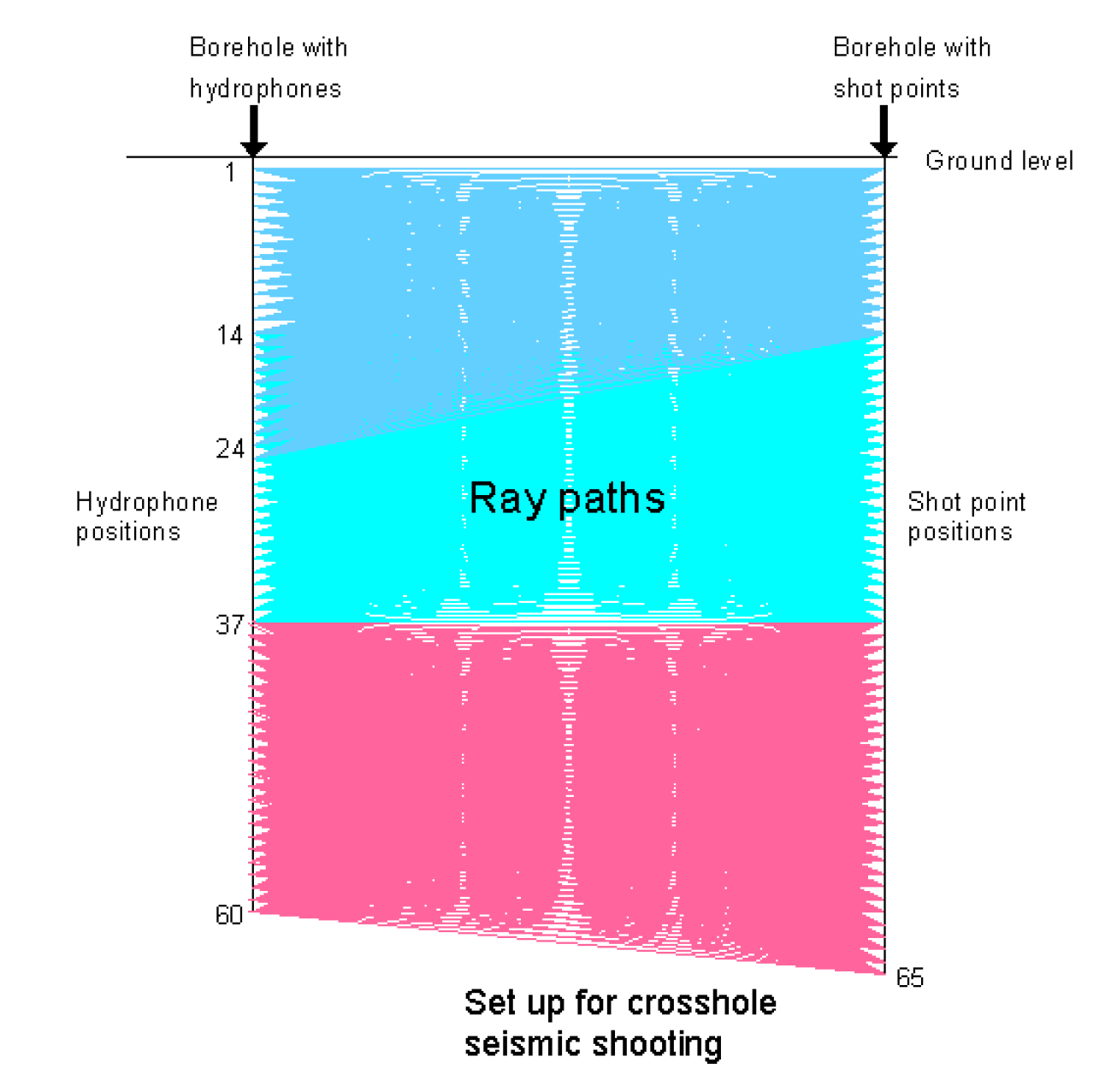
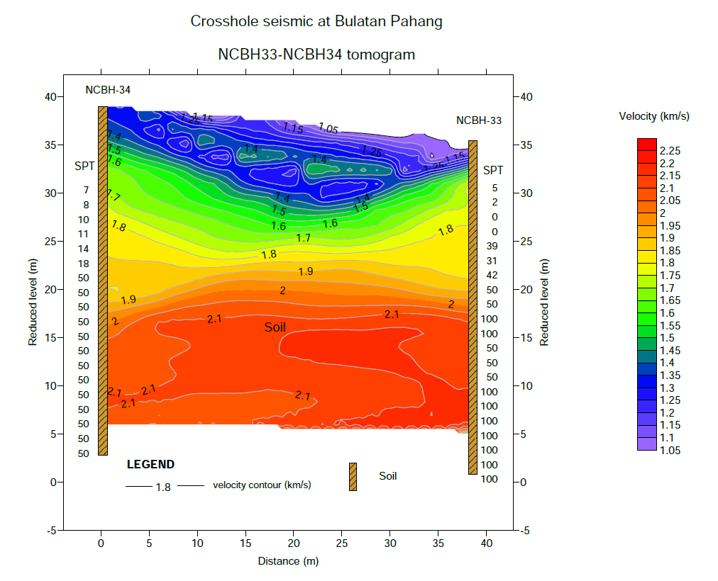
The method involves placing a seismic source in one borehole and receivers (geophones) in adjacent boreholes. The travel times of seismic waves between the source and receivers are recorded to calculate wave velocities, providing insights into material stiffness and stratigraphy.
Key Components
- Seismic Source: Generates P- or S-waves (e.g., mechanical impactors).
- Receivers: Geophones or hydrophones placed in adjacent boreholes.
- Recording Equipment: Captures seismic waveforms and travel times.
Applications
Crosshole seismic surveys are widely used in engineering and geotechnical investigations. Common applications include:
- Determining shear and compressional wave velocities
- Evaluating soil and rock stiffness
- Assessing liquefaction potential
Advantages
- High-resolution data for localized areas
- Accurate velocity measurements
- Direct evaluation of in-situ conditions
Limitations
- Requires multiple boreholes
- Relatively high cost compared to surface methods
- Limited to areas accessible for borehole drilling